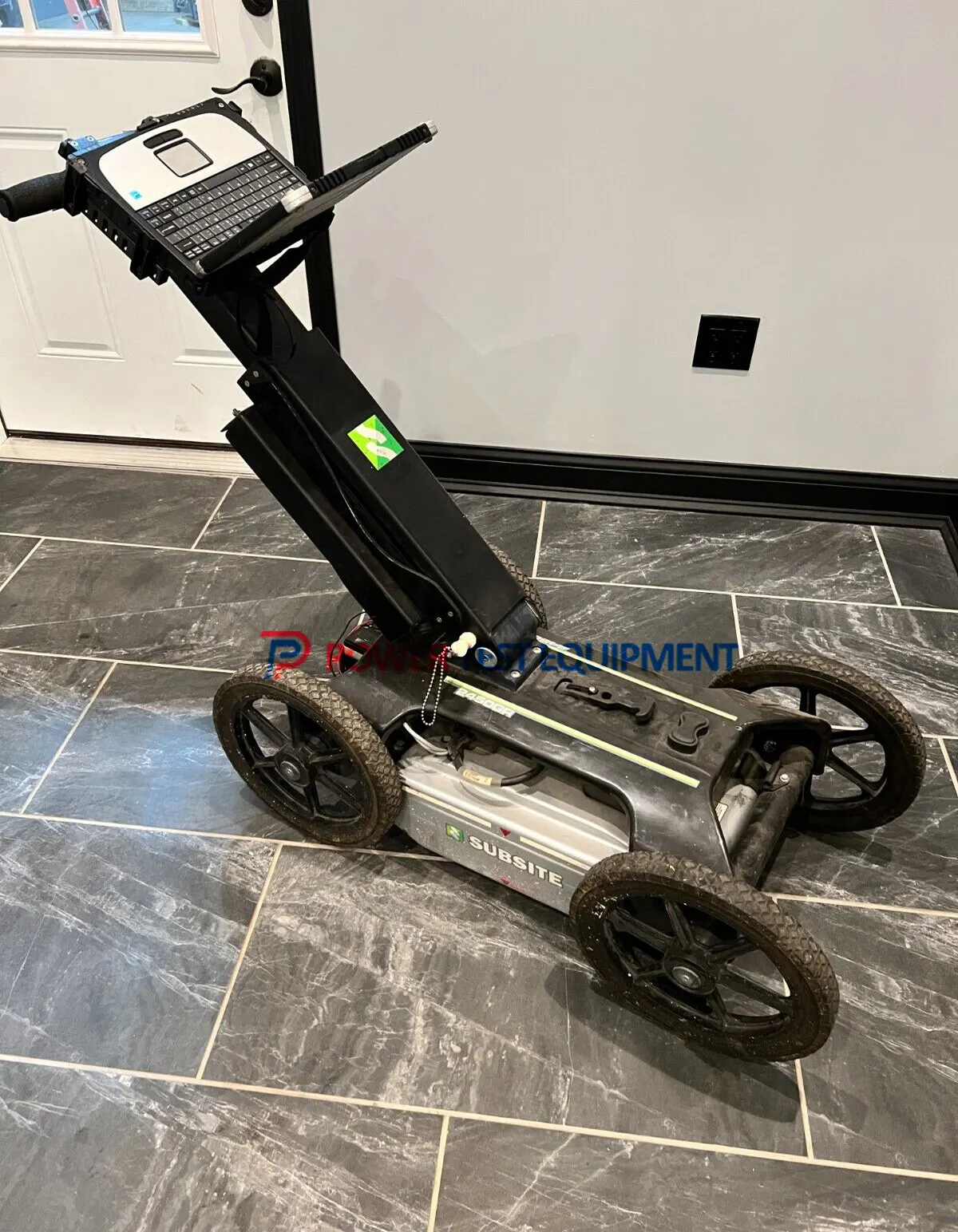
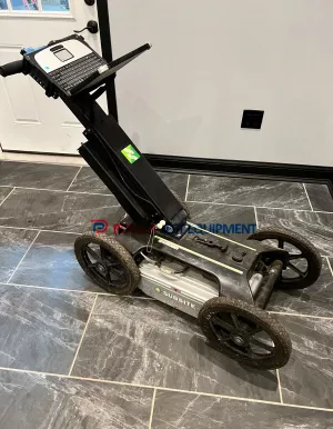
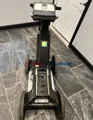
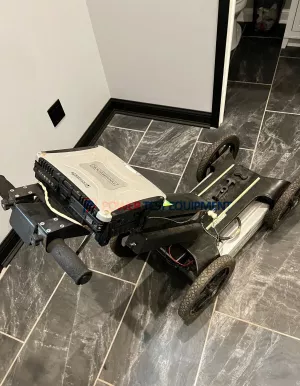
Used Subsite 2450GR Ground Penetrating Radar
Certified used Subsite 2450GR GPR for sale, fully inspected, tested, and is ready for field use to locating and mapping underground utilities, non-metallic pipes, conduits, and subsurface structures.
Related Products
Product Description
Certified used Subsite 2450GR GPR for sale, fully inspected, tested, and is ready for field use to locating and mapping underground utilities, non-metallic pipes, conduits, and subsurface. structures.
This used Subsite 2450GR GPR is clean, well-maintained, and in excellent working and cosmetic condition, showing very little signs of prior use.
Subsite 2450GR ground penetrating radar system is an invaluable utility locating device designed to help subsurface utility engineers and other contractors locate any type of utility, both metallic and non-metallic, beneath soil, rock, pavement and other surfaces. The 2450GR's advanced locating capability makes it ideal for a wide range of other applications, including detection of voids, sinkholes, concrete and underground storage tanks.
Features
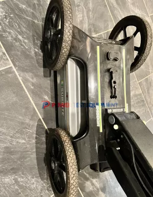
- 2450GR locates both metallic and non-metallic pipes and cables at depths of up to 19.7 feet (6 m), depending on soil conditions.
- 2450GR folds up into a size that is easy to transport.
- With 5.6 mph (9 km/h) survey speed and digitally controlled radar, the 2450GR provides fast, clear images.
- Earth-engaged antenna provides better contact on uneven terrain and reduces signal loss.
- Rugged, four-wheel design allows the operator to scan in the roughest conditions.
- Dual-frequency antenna allow the operator to see both deep and shallow objects simultaneously.
2450GR GROUND PENETRATING RADAR SPECIFICATIONS
| U.S. | METRIC | |
| SYSTEM | ||
| Survey path width | 19.68 in | 500 mm |
| Recording channels | 2 | |
| Transmit pulse frequency | 200 kHz | |
| Typical antenna frequency | 250 and 700 MHz | |
| Typical collection speed (scans/second) | 100 | |
| Typical collection speed at 2-in (5-cm) sampling interval | 5.6 mph | 9 km/h |
| Display mode | Gray scale/color palette | |
| Zoom | Up to 4x | |
| Data storage | Laptop hard drive | |
| Profile length, max | Virtually unlimited | |
| Stored data format | Raw data (for further data analysis) | |
| Setting of GPR propagation velocity (to get accurate evaluation of depth of detected targets | Ground truth or hyperbola fitting methods | |
| Reading of pipe position/depth | Software cursor | |
| System output | Printable radar map with descriptor of detected utilities | |
| Diagnostic | Radar and power supply status, excessive speed, data loss | |
| Languages | English, French, German, Spanish, Italian, Portuguese, Chinese | |
| Data collection type | Parallel profile lines, perpendicular to the expected orientation of utilities | |
| RADAR POWER REQUIREMENTS | ||
| Battery operating time | <10 hours | |
| Power supply | 12V sealed lead acid, 12 Ah | |
| Mechanical | ||
| Operating temperature | 14-104°F | -10-40°C |
| Humidity | 100% (sealed) | |
| Weight, w/out battery or PC | 60.6 lb | 27.5 kg |
| Weight, w/out PC | 68.6 lb | 31.1 kg |
| Weight, total | 73.9 lb | 33.5 kg |
| Width | 21 in | 533 mm |
| Length, handle fully extended | 49.92 in | 1.27 m |
| Length, folded | 39.96 in | 1.02 m |
| Height, handle fully extended | 39.48 in | 1 m |
| Height, folded | 20.4 in | 521 mm |
| DUAL FREQUENCY | ||
| Antenna technology | Ultra-wide band, ground coupled, shielded dipole | |
| Typical range | .32-8.2 ft | 0.1-2.5 m |
| Range, max | .32-19.7 ft | 0.1-6 m |
| RECOMMENDED PC SPECIFICATIONS | ||
| Processor | 1 GHz or faster | |
| RAM | 512 MB or more | |
| Display resolution | 800 x 600 or higher | |
| Hard drive | Shock proof or solid state | |
| Hard disk space | 100 MB available | |
| Ethernet connection | 100 Mbps | |
| USB connection | USB 2.0 | |
| Operating system | Windows® 2000 Professional SP4, Windows® XP Professional or Windows® 7 |
|